History
The District is a municipal utility district created by an order of the Commission, dated February 13, 2003, under Article XVI, Section 59 of the Texas Constitution, and operates under the provisions of Chapter 49 and Chapter 54 of the Texas Water Code, as amended, and other general statutes of Texas applicable to municipal utility districts. The District, which lies wholly within the corporate limits of the City of Houston, is subject to the continuing supervisory jurisdiction of the Commission.
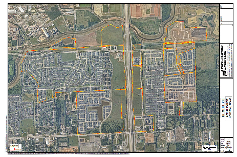
The District is located in southern Harris County within the corporate limits of the City of Houston, approximately 8 miles south of the central downtown business district of the City of Houston at the intersection of State Highway 288 and West Orem Drive. The District is located entirely within the boundaries of the Houston Independent School District. The District consists of approximately 867 acres of land.
Approximately 508 acres have been developed into the single-family subdivisions of City Park, City Park West, City Park South, and City Gate, which collectively encompass 2,854 lots. As of November 30, 2022, 2,329 homes were completed, 75 homes were under construction, and 450 developed lots remained vacant.
District Map